MyTopo Waterproof Topographical Maps, by Thomas Christianson

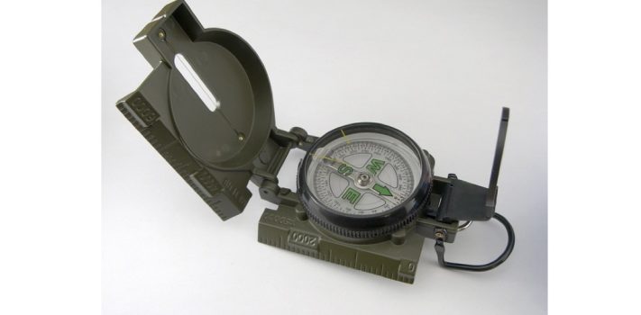
Have you ever tried to read a map in the rain? Or a map that got wet when a canoe tipped over? Or a map that accidentally got dropped in creek that you were crossing? If you have, you know that water and maps are not on very friendly terms with each other. MyTopo Waterproof Topographical Maps offer outdoorsmen a more weather-resistant navigational aid than traditional paper maps. MyTopo maps are waterproof, frostproof, and stand up to repeated folding better than traditional paper maps. They are available in the newest post-2009 USGS quads, the classic pre-2009 USGS quads, game management …


Prepper Group Training: Indigenous Guerrilla Teams – Part 2, by Bulldog

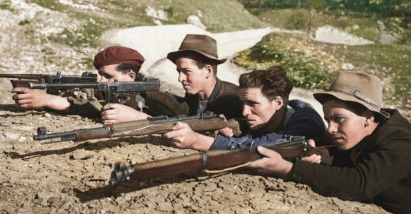
(Continued from Part 1. This concludes the article.) The Challenge To understand why I feel we are lacking in our preparation of these men and women, let us look at only one necessary skill set, team radio communications. Certainly we could agree that it represents one of the key core elements critically necessary to prepper and survivalist groups. Yet, in most cases it is overlooked or minimized by group leadership. Instead, we relegate programming to the “commo guy” and hope that after stuff hits the fan (SHTF), group members will somehow magically demonstrate more interest. Please understand that I am …


Come Home, Now!, by M. Paul

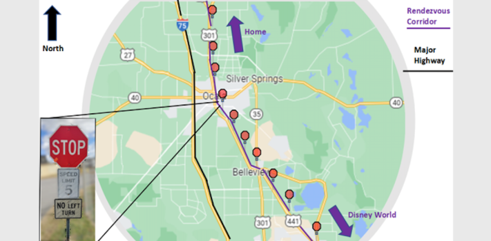
This article is addressed to my adult children and their families. It should be useful to those readers who have family members who are spread out across a region of the country. It is intended to provide information and logistics for improving the odds of successful transport for those who may be planning to come “home” when there are natural disasters, or the Stuff Hits The Fan (SHTF). Disasters, in my judgment, can range from large storms, tornados, large fires, and floods, all the way up to EMPs, world war, or deep societal breakdown. Each of these, to varying degrees, …


Solo Road Travel, by Hollyberry

THE PLANNING STAGE I live in Maine, and my mom lives in New Jersey. The drive, one way, is 550 miles. Depending on weather conditions and traffic, the drive will take 9-10 hours. I have been making this trip several times a year for about 19 years now. Due to mom’s declining health I have been required to travel more frequently. We have some animals/livestock that need attending to so my husband stays home on “homestead duty”. I wish my dogs were car dogs but they would make that 10-hour drive even longer so I go by myself. Over the …


Road Trip Navigation, by R.T.

This is about our cross-country road trip; not about where we went, what we saw or what we did, but about how we got there and how we found our way back. Why should this journey be of interest to you? Because someday you might have to make a road trip that doesn’t go as planned, or maybe not even planned at all and with little or no technological help. My wife and I are occasional long-distance travelers. The long-distance road trips we have made have been primarily to the same destination for family events via variations of the same …


Follow the Yellow Brick Road – Part 4, by J.M.

(Continued from Part 3. This concludes the article.) Resources Once you have your route options figured out and taken into account potential obstacles and hazards, the next step should be to take a look at potential resource requirements and availability. The first resource I will typically look at is food – I always have some amount of emergency food stocked in my travel kit, including bags of nuts, trail mix, Fritos, emergency ration bars, small freeze-dried meals, etc. However, for any trip home longer than 3-to-4 days it becomes difficult to pack enough food to account for the whole trip, …


Follow the Yellow Brick Road – Part 3, by J.M.

(Continued from Part 2.) The Weather The next thing I look at when starting a trip plan is what the weather will be like at my destination as well as locations between my destination and home. For a shorter get-home journey these may be pretty much the same, but depending on distance, terrain and weather patterns you might experience very different weather in locations even 10 miles apart. For route plans that I use on a regular basis I’ll usually include monthly averages chart and just check the 10-day forecast shortly before I pack. Here’s a screen clip of the …


Follow the Yellow Brick Road – Part 2, by J.M.

(Continued from Part 1.) Railroad tracks are another possible route that you could use to get home, but doing so can potentially be very dangerous – unless you’re in a grid-down scenario and you’re absolutely sure trains aren’t running then I strongly recommend you avoid them. If you can use them safely they could provide a possible route that’s typically isolated and free from obstacles. Railroad bridges are potentially less likely to be monitored or blocked, so if you need to cross a terrain feature like a river or steep gully while avoiding contact they may be a better option …


Follow the Yellow Brick Road – Part 1, by J.M.

In The Wizard of Oz, Dorothy’s mantra is “There’s no place like home, there’s no place like home”, and the entire movie is pretty much about her following a yellow brick road to get there. Many of us spend a good chunk of our lives away from home, whether it’s at work, on vacation, visiting family or friends, or just going on a camping, hunting or fishing trip. If you spend any amount of time more than a few miles (or kilometers) away from your home or bug-out location (BOL), there’s a chance that an emergency or disaster might strike …


The Modern Breadcrumb Trail, by BowtiedPartisan

Introduction Modern life in a First World country is fantastic. Access to everything you need. What’s even more beneficial, is having a computer in your pocket. That’s right, your smartphone, it’s a computer and a radio transceiver. It can communicate with almost anyone in the world via radio waves and the Internet. All it needs to do is reach a cell phone tower. Let’s focus on a few aspects of this though, what the cell phone was originally created for, and what it has replaced. It plays a part in understanding your reliance on this device. Cellphones were primarily created …


The Prepper Potential of an Old Cell Phone, by Mr. Zipph

Over the years, I have read many articles on communications in a grid-down situation. Those articles typically focus on using ham radios or CB radios to communicate with other like-minded folks in a TEOTWAWKI scenario. I have also read articles focused on the importance of gathering and accessing important information that you would need if the Schumer hiints the fan (TSHTF). These articles typically discuss the importance of having hard-copy books and printed planning information, contact information, and other important information that would be valuable to have. I first suggested the importance of a cell phone in preparedness efforts in …


Guest Article: Maps and Pins Won’t Save You, Part 1, by Kit Perez

Editor’s Introductory Note:  This article on Intelligence first appeared at the excellent American Partisan web site, and is re-posted with permission.  Part 2 will be posted on Saturday, February 2, 2019. I recommend American Partisan as “must reading.” Consider bookmarking it. — Part I: Understanding Your AO There’s a disconnect among many in the prepper community between information and intelligence. In recent years, a disturbing notion has become fashionable; namely, that in order to effectively operate in your area — whether it be due to a societal meltdown of some type or a natural disaster — you need a big …


Letter Re: Cell Phone Masking and Denial of Geolocation Data

Hello James, I was stunned when out of the blue Google Maps sent me an e-mail detailing several hundred locations I have been to over the past several months. I immediately attempted to change settings to prevent this, but I feel Internet/cell phone data is an insidious invasion of privacy with the next logical step for government to bypass the usual requirements to access locations, phone numbers, data, et cetera, the 4th Amendment be damned. There are various RFID-blocking cell phone wallets/sleeves for sale online with varying degree of price and effectiveness as per reviews. Can you recommend a product …


Enjoying (and Surviving) Solar Eclipse 2017

On August 21, 2017, residents of a narrow swath through the United States will have a rare treat: The chance to observe a total eclipse of the sun. The path of totality will transit several major cities, including Greenville, South Carolina and parts of St. Louis, Kansas City, and Nashville. In the west, most of the viewing will be in smaller towns, since major cities, like Denver and Portland, are well outside of the path of totality. Because this eclipse is occurring in mid-summer (with a lower chance of cloud cover), there should be good opportunities for viewing, if you …


Keep Your Bicycle Running in Tough Times, by S.H.

A lot of times you’ll hear folks say that doing some activity is like riding a bicycle; once you know how to do it, you’ll always remember. Well, it’s true that no matter how long it’s been since you’ve ridden, you can get back on your bicycle, but only if you remember you have one! One thing I’ve noticed in a lot of posts regarding times post-after the Big Schumer hits the fan is the gap that bicycles could fill for transport needs. Notably, bicycles were employed by a few characters in the book Patriots, so kudos to Mr. Rawles. …