
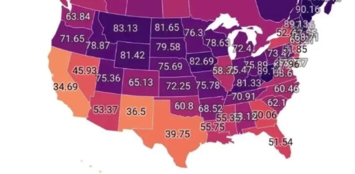


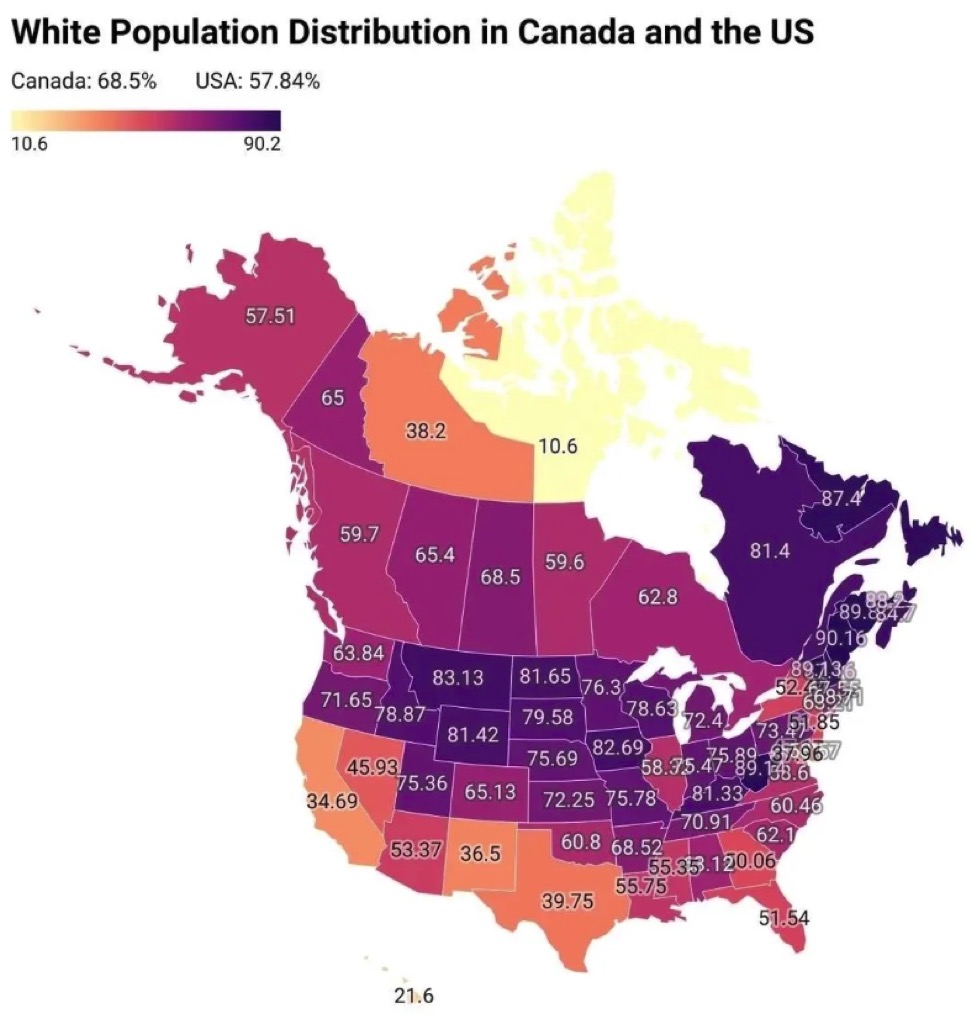
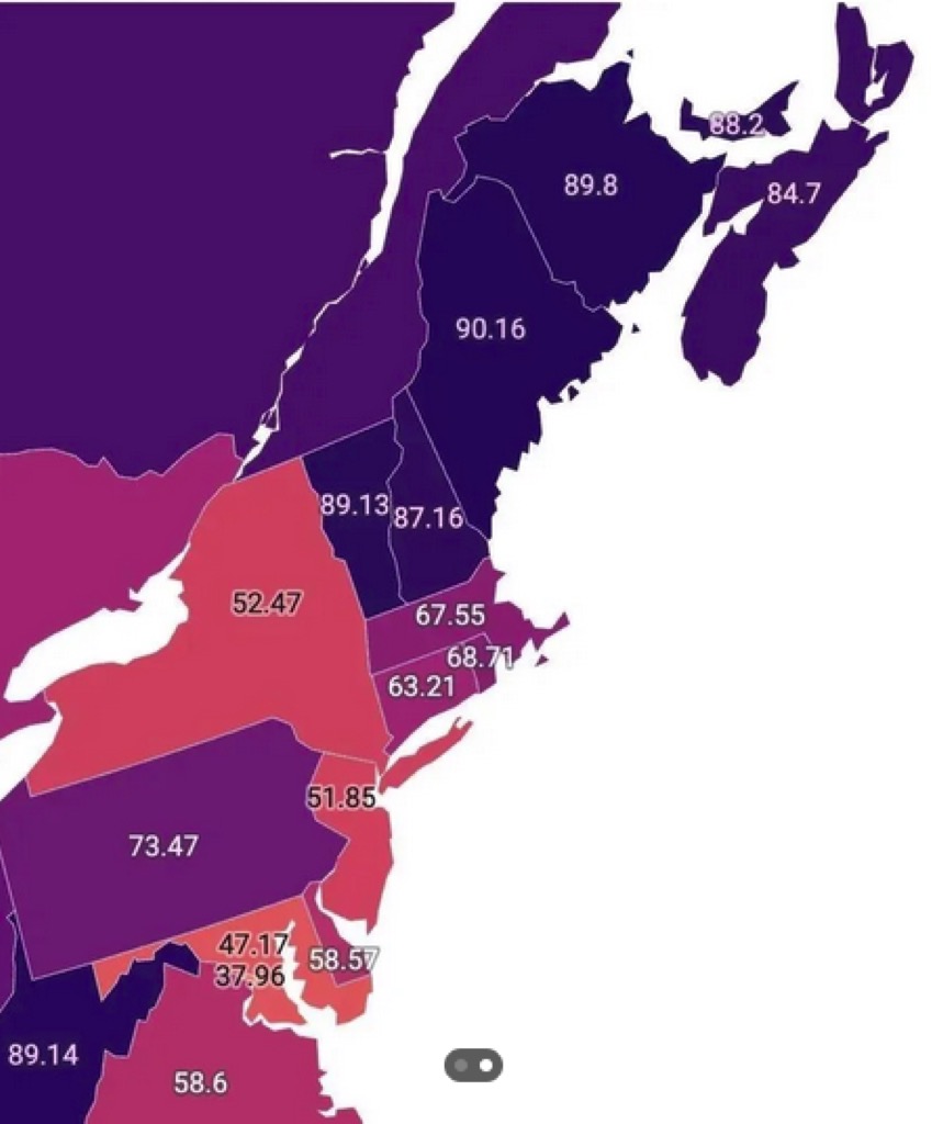
Today’s graphic is a map that shows the white population distribution by percentage throughout the American states and Canadian provinces. (Graphic courtesy of Reddit.) The lower detail map shows the small northeastern states.
The thumbnail images below are click-expandable.
—
Please send your graphic ideas to JWR. (Either via e-mail or via our Contact form.) Any graphics that you send must either be your own creation or uncopyrighted.