
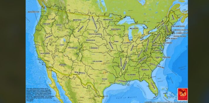


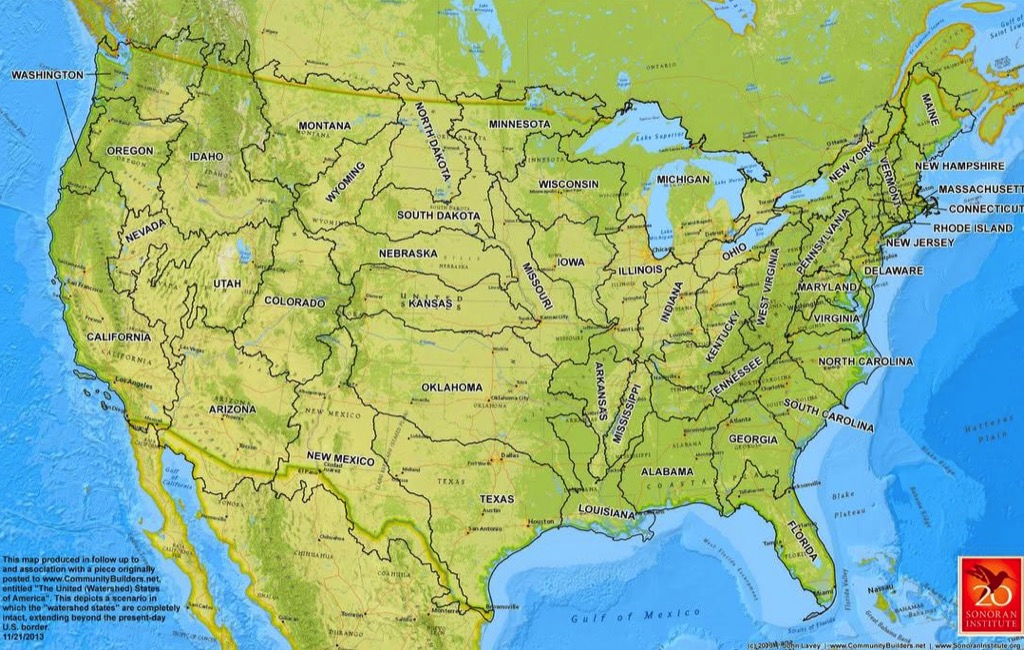
Today’s graphic is a map showing the United States divided by watersheds, as proposed by explorer, cartographer, and USGS Director John Wesley Powell. (Graphic courtesy of Reddit and the Sonoran Institute.)
The thumbnail image below is click-expandable.
—
Please send your graphic ideas to JWR. (Either via e-mail or via our Contact form.) Any graphics that you send must either be your own creation or uncopyrighted.