
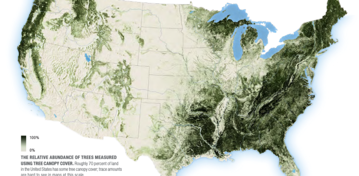


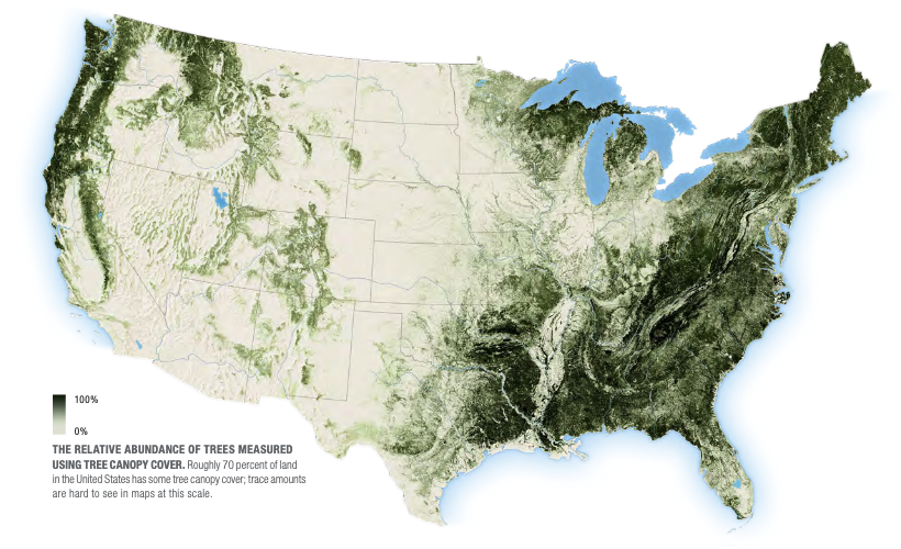
Today’s graphic: Map of Tree Canopy Cover in the United States. (Graphic courtesy of the USDA.)
For the full dataset with useful variant raster maps, see: https://data.fs.usda.gov/geodata/rastergateway/treemap/index.php
The thumbnail below is click-expandable.
—
Please send your graphics or graphics links to JWR. (Either via e-mail or via our Contact form.) Any graphics that you send must either be your own creation or uncopyrighted.