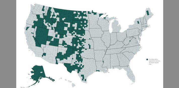


Today’s graphic is a map showing the Frontier Counties of the United States. To qualify as “frontier”, a county must have six or fewer people, per square mile.
(Graphic courtesy of Reddit.)
The thumbnail image below is click-expandable.

—
Please send your graphic ideas to JWR. (Either via e-mail or via our Contact form.) Any graphics that you send must either be your own creation or uncopyrighted.