I have always been interested monitoring ships and air traffic around the world, especially since 9/11. On that day I was fishing for salmon out of the middle of Lake Michigan, a very clear day and I noticed every jet in the sky was turning into a different direction heading somewhere else. Turning on the Marine radio and started to hear the chatter of what was going on around the country, I finished my sandwich and headed the boat for the harbor.
Since then I have learned of several websites that show real-time movement of ships and airplane around the world. Almost any airplane that can fly above 10,000 feet or with a set number of miles of class A, B, or C airspace will have a transponder providing their position and identification. I’m not a pilot (although it is on my bucket list to get a pilot’s license) so I don’t know the exact rules on transponders but I wanted to point out the ability of the public to monitor planes in the sky. Think of this as Open Source Intelligence. (OSINT.)
The is a few websites where you can see real-time movement of planes through the sky but the most popular and free on is “Flightaware.com [1]”. Scroll down to the map and click “track now” and the map will open showing a part of the world and air traffic. Simply scroll around the map and zoom in with your mouse (a mouse with a roller works best). When you zoom out you can almost see the highway in the sky of paths that most planes take across the world.
To use the software, zoom into an area of interest and hover over a plane or helicopter symbols. Note the symbol will be moving but a window of data will pop up showing information about the aircraft.
On commercial aircraft you will see airline and tail number such as SWA1405 B38M. This represents “Southwest Airlines, tail # 1405” and the make of the airplane, B38M which is a Boeing 737 Max.
A quick Google search such as “airplane B38M” will usually give you the make and model of the airplane. Below that you will see two sets of numbers, in this case 36000 455 which means it is flying at 36,000 feet and moving at 455 MPH. Below that is a third set of numbers and letters and in this case it was “ALB MDW 9:13AM” which represents it left Albany, New York and is flying to Chicago Midway and will arrive at 9:13 AM. Click on the plane and it will show you all of this information and the planned flight path from beginning to end. Scroll down on that page and it will provide the flight history of the aircraft over the past week or so.
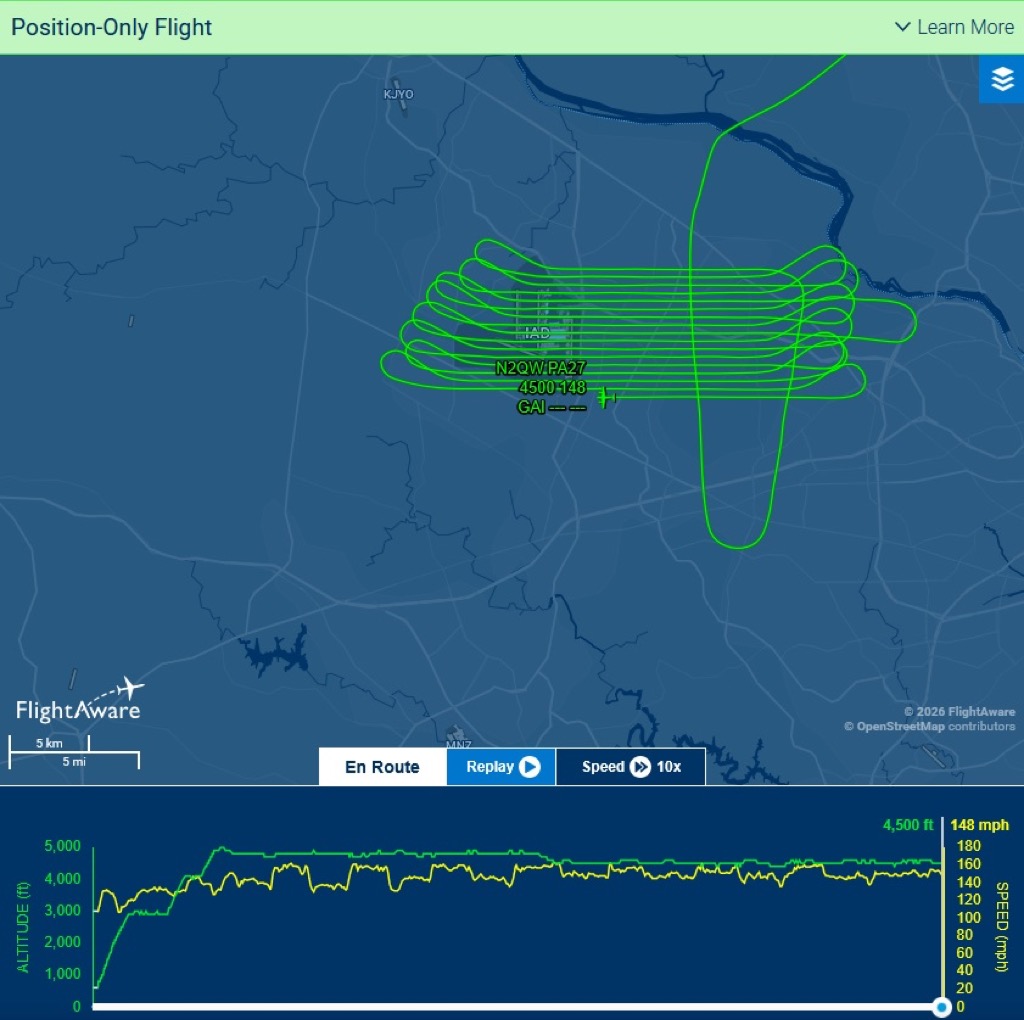
So I am interested in government surveillance flights where a plane will fly a grid over an area all day collecting some type of information on the ground. These planes usually fly under 7000 feet and under 200 MPH and will fly over an area in a pattern, much like how a farmer plows a field. There is a filter in the map to filter only aircraft flying in the parameters you request to make it easier to spot such flights.
Typically, a surveillance plane will fly an area and get to the end of the observation area, turn 180 degrees and fly a straight line next to the last pass. I have observed this many times and recently found two planes flying the same exact path except one was 100′ higher than the other. the following are examples screenshots of such activity. On the left is one example of a surveillance flight as shown on FlightAware.com. On the right is another view.
 [2]
[2]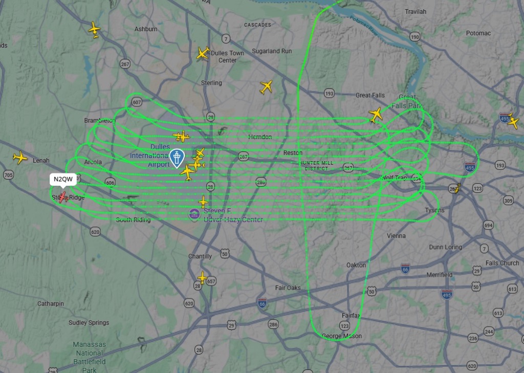 [3]
[3]
When you research the tail numbers, they are almost always held by a company.
Don’t confuse university flight program pilot because those tail numbers will end with multiple letters such as BG (Bowling Green University) or OSU (Ohio State University) and they will often do touch-and-go landing at the runways and will include the same take-off and landing airport.
Another Flight monitoring website is “Flightradar24.com [4]” which operates much like the Flightaware software but more colorful and easier to use. It provides flight paths, history, aircraft details as well. The same surveillance flight as shown above as seen on FlightRadar24.com below.
 [5]
[5]
Military aircraft rarely show up on either system. If you are interested in seeing military aircraft, there is a YouTube Channel called “Monkey Werx” where he subscribes to a software package called “SkyGlass”. He filters through the air traffic and sorts out the military flights around the US and overseas. He will explain what each type of aircraft does, his opinion of what is usually hauling (such as presently moving munitions from the US to overseas, and discusses the various military aircraft. I find his channel fascinating because he will show the paths of refueling tankers, AWACS, cargo transport, nuke sniffers, anti-submarine warfare planes, data-gathering balloons, and some mystery government planes that turn off their transponders mid-flight. In the rhe latter part of his show he discusses events happening in parts of the world and his opinions and the latest SITREP. He is a Christian and prior service military, as well.
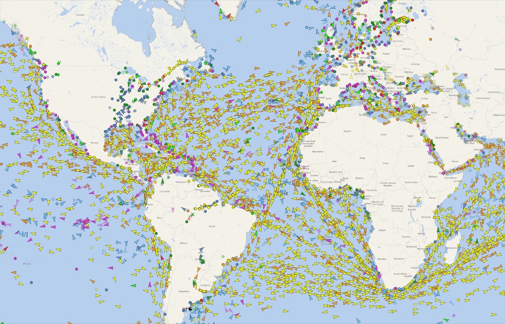
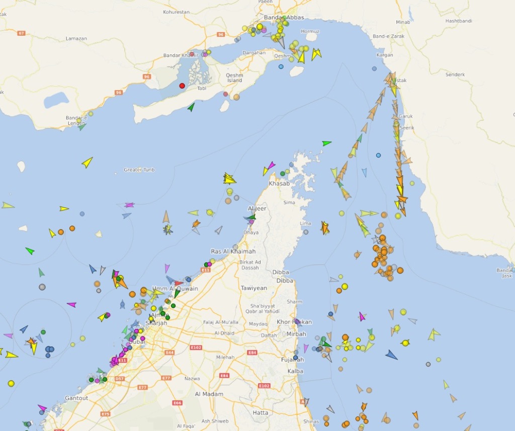
Now, if you wish to monitor worldwide ship traffic, there is a website called “Vesselfinder.com [6]”. It is another amazing website showing real-time ship traffic anywhere in the world.
 [7]
[7]
The more that you look, the more interesting things you can find, using open source intelligence.